GPS-Denied Navigation
Validating GPS-denied drone navigation in hardware-in-the-loop
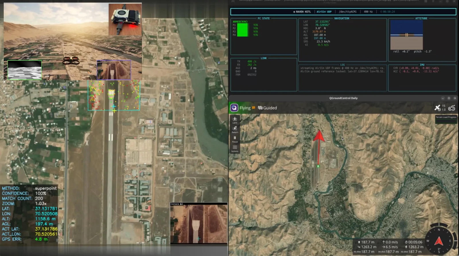
A hardware-in-the-loop setup connected a real flight controller running ArduPilot to RUNE Sim, validating vision-based GPS-denied localization in repeatable, photorealistic scenarios — demonstrated over real-world terrain.
Challenge
GPS is one of the first signals to fail in contested environments — jammed, spoofed, or simply unavailable. Autonomous platforms that depend on it stall exactly when they are needed most.
Validating GPS-denied navigation on real flight hardware — safely, repeatably, and before risking an aircraft — is hard. Field tests are expensive, slow, and difficult to reproduce, and pure software simulation never exercises the real flight-control firmware that ultimately flies the platform.
Solution
We connected a commercial flight controller, running its real ArduPilot firmware, to RUNE Sim through a custom hardware-in-the-loop (HITL) bridge. RUNE Sim streams synthetic IMU, GPS, velocity, altitude, and rangefinder data to the bridge, which converts it into the flight controller's expected format over USB. The controller runs its actual EKF, navigation, and control loops; its motor outputs are read back into RUNE Sim, closing the loop. A separate link carries command and telemetry messages.
Meanwhile, Raven Nav's vision algorithms estimate the drone's position from onboard imagery alone — no GPS. Because the whole loop runs in a photorealistic, repeatable simulator, the same scenario can be flown again and again to develop and validate guidance, navigation, sensor integration, and flight-control behaviour on real hardware.
Results
Real flight firmware in the loop — A commercial flight controller's actual ArduPilot EKF, navigation, and control loops were flown in a repeatable simulator via the HITL bridge, with end-to-end latency typically 1–4 ms.
GPS-denied localization, demonstrated — Vision-based position estimates were produced over real-world terrain at two locations — with roughly 20 m error at about 200 m altitude in this early proof of concept, and a clear path to tighter accuracy as the vision system matures.
Validation before flight — Guidance, navigation, sensor integration, and flight-control behaviour were exercised on real hardware before any physical flight test — reducing cost and risk.
Watch the demos
GPS-Denied Drone Localization — HITL Demo over Fayzabad
This video is hosted on YouTube and may set cookies when loaded.
GPS-Denied Drone Localization — HITL Demo over Fayzabad
GPS-Denied Drone Localization — HITL Demo over Zagreb
This video is hosted on YouTube and may set cookies when loaded.
GPS-Denied Drone Localization — HITL Demo over Zagreb

Want to see it for your mission?
Tell us about your operation and we'll show you what we can demonstrate.